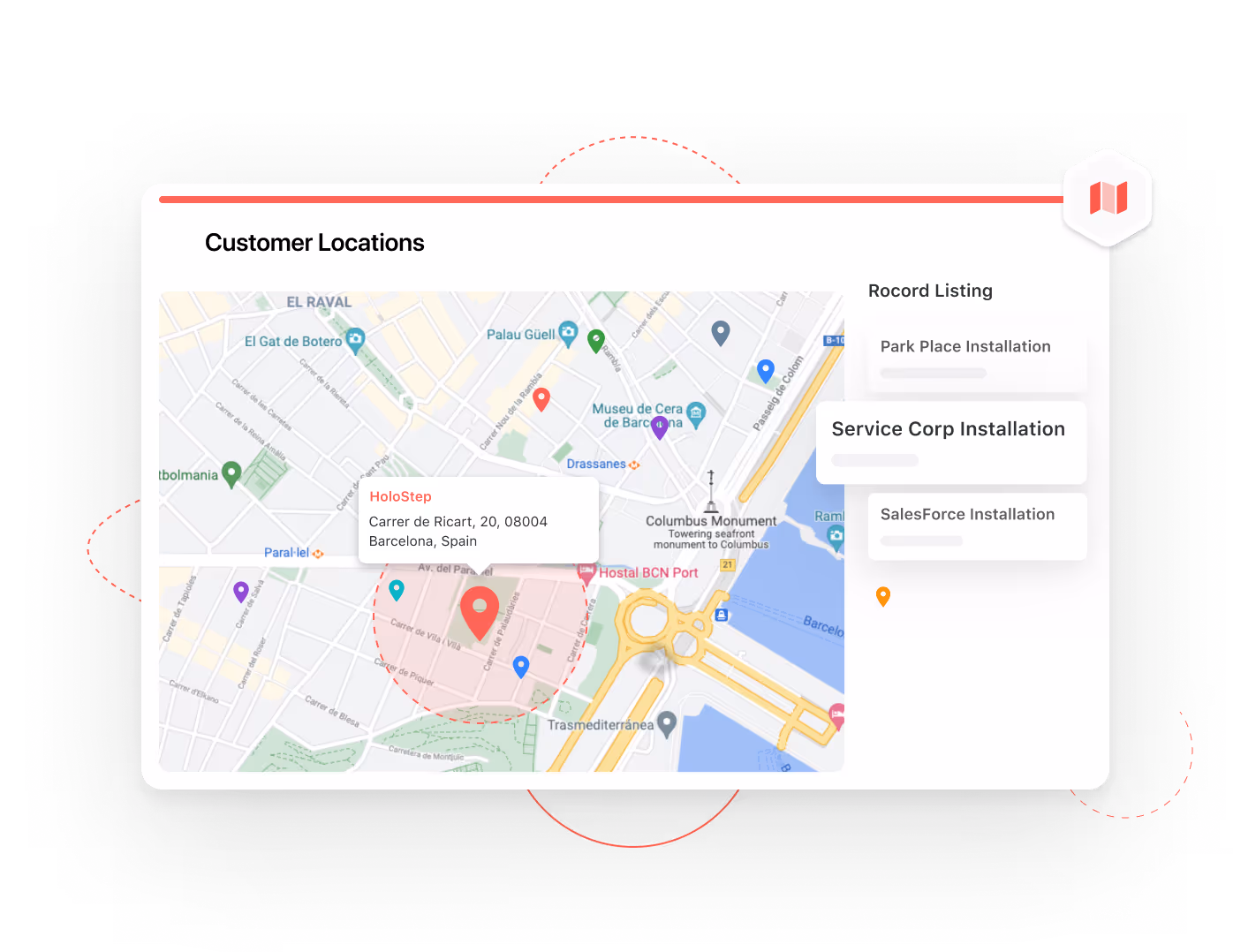
Map View
View any of your location data in a fully interactive map format that includes powerful display features. SmartSuite is your digital playground for physical locations.
Digital Meets Physical in Map View
Map Your Data
Anywhere on Earth
Businesses working in the physical world need digital visualization tools to meet them where they are. It's particularly useful for teams in the field working on anything from real estate and property management to deliveries and construction job sites. From Australia to Alaska, if it has a location, we can map it.
Map Any
Address Field
We automatically recognize address fields and map records geographically, displaying a pin and preview of the address. One click expands to view the entire record in the context of the map.
One-Click to
Map Directions
Never get lost again trying to remember an address. Pull up driving directions from anywhere with a simple click.
Color & Customize
Location Markers
Ohhhhhh pretty colors. Set colors and select sizes for location markers to help segment your data at a glance.
Customize Your
Map Elements
You’re going to be a regular Gerard Mercator in no time (only the most famous mapmaker of all time, read a book). Choose every level of detail you want from your view, visualizing your data EXACTLY how you want it. No one else offers this...and it’s super fun to play with.
Add As Many
Addresses As You Want
We don’t limit your data. Add all your addresses, right away...it just takes a couple of seconds.
Map Your Data
With Radius
Apply a radius to any address data to visualize distance from locations in miles, feet, kilometers, or meters. Great for mapping territories or delivery zones. It also kind of looks like a Venn Diagram, which is pretty nifty.
View Addresses
In Context
One click opens the Record Listing panel, which displays all available addresses in the view. Use controls such as Sort, Group, and Spotlight to locate records. Drag and drop items directly into the view to customize what you’re seeing.
Switch into
Street View
Grab the person icon in the lower right-hand corner of any map, then drag and drop anywhere on the map to instantly switch into Google Street View. Navigate to view records in real life. It's an entirely new level of visualization - make sure you wave next time a Google car drives by!
Zoom In and View
3D Cityscapes
Set your view to Hybrid or Satellite mode, then zoom in on urban settings to view cityscapes and buildings in 3D. Get a feel for the surroundings of all your physical addresses, even if you’re thousands of miles away.
How Customers Use Map View
Explore real-world use cases to get inspired for how Map View can be used in your work.
Report Toolbar Controls for Map View
Track physical locations in your digital world
Address Selector
Select among address fields in an application to display in Map View.
Sort
Sort your data in the way it makes sense for you, whether that's alphabetical, by a numeric value, by date, or something cool completely unique to you.
Filter
Filter your data by any other field, returning just the items you're looking for.
Grouping
Group your data by the value of other fields, helping you organize and understand complex information easily.
Spotlight
Give special visual attention to important information by creating rules that match and highlight conditions or values you specify.
Find
If you're looking for a particular bit of text in your records, you can quickly use the find filter to narrow things down.
Full Screen Map
Maximize your SmartSuite real-estate by flipping to full screen mode for any view type.
Print / Export Reports
Print in a couple clicks, or export to PDF, CSV, Excel or Google Sheets.
Map Record Listing
View a listing of all the records in an application. Click any tile to jump to individual records on the map.
Frequently Asked Questions
What is SmartSuite's Map View?
SmartSuite's Map View is an interactive mapping feature that allows you to visualize location data on a fully interactive map. It's designed for businesses and teams that operate in physical spaces, making it ideal for sectors like real estate, deliveries, and construction.
How does Map View handle address data?
Map View automatically recognizes and maps address fields, placing a pin and address preview on the map. A single click expands this view to show the full record in the map context, enhancing your spatial data management.
Can I get directions within Map View?
Yes, Map View includes a one-click feature to pull up driving directions from any location, ensuring you never have to struggle with remembering addresses again.
How can I customize location markers in Map View?
You can customize your map's location markers by setting colors and selecting sizes. This feature allows for easy segmentation and visualization of your data at a glance.
What customization options are available for map elements?
Map View offers extensive customization for map elements, allowing you to adjust detail levels and visualize data precisely as you need. This flexibility ensures that your mapping needs are met with precision and creativity.
What is the purpose of the radius feature in Map View?
The radius feature in Map View lets you apply a distance radius to any address, useful for visualizing territories, delivery zones, or proximity in various units. This adds a dynamic layer to your data visualization efforts.
How does Street View work in Map View?
By dragging and dropping the person icon from the map's corner into Street View, you can navigate and view records as they appear in real life. This immersive feature offers a new level of visualization for your location-based data.
Which SmartSuite plan types provide access to the Map View feature?
The Map View feature is available to all SmartSuite plan types, including Free, Team, Professional, Enterprise, and Signature. This ensures that any team, regardless of size or budget, can utilize this powerful tool to enhance their location data visualization.
Follow our map to the future of work.
View location data in a fully interactive map format.